|
Program
for Managing the Risk due to Natural and Anthropogenic Threaths in the
Municipality of Pilón,
Granma Province, Cuba.
Engineers Fernando Guasch Hechavarría, Belmis Avich Durán
and Eberto Hernández Surós
National Center for Seismic Research.
Ministry of Science, Technology and the Environment, Republic of Cuba.
BACKGROUND
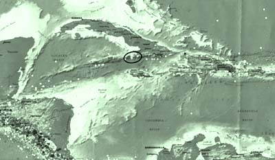
Pilón is located on the border of two great regional structures:
The Sierra Maestra Anticlinorium and the Barlett Deep (Cobiella, et al,
1988). Tectonically, this territory is found within what is called the
Pilón Block (Guasch, et al, 1992). Its limits are the Bartlett-Cayman
Fault to the south and a system which separates it from Western Sierra
Maestra, from the east to the west.
The seismic activity
of Eastern Cuba reveals that the coastal municipality of Pilón
has been the most affected area during the last 25 years, due to the occurrence
of seisms of great intensity.
A detailed macro-seismic
study of both earthquakes that occurred on February 19, 1976 (Imax = VIII)
and on May 25, 1992 respectively (Imax = VII), states that the intensity
reported in Pilón, additionally to being associated with the hypocentral
distance and the earthquakes’ magnitude itself, reflected a number
of local geological, tectonic, engineering and geological conditions,
which decisively influenced the structural response of a number of buildings
in this locality, as well as the damages produced in such buildings. (Guasch,
F. et al, 1992)
As a result of this
research and previous studies, a Forecast Outline for Seismic Risk was
established, in order to optimize land use and utilize available construction
systems.
Additionally, a number of studies were carried out within the municipality
of Pilón, to determine the structural and non-structural seismic
vulnerability of health, education and communication facilities. These
studies were developed in the context of the National Defense Program
(different authors, 1998) and were characterized by the breadth and depth
of their analysis. As a result, recommendations were made in order to
reduce this risk.
To date, housing has
not been a focus in these studies, especially regarding prefabricated
buildings, in which most people live. These houses or buildings are technically
unsound, since their strengthening structures are rusty. Therefore, it
is necessary to conduct a detailed study, through a number of tests, to
analyze the possibility to restore and/or repair these buildings.
This locality has
been affected by a series of hydro-meteorological phenomena. During the
last 30 years, for instance, the occurrence of 7 tropical cyclones have
been reported. Furthermore, Pilón often endures intense droughts,
resulting in the declaration of a state of emergency twice during the
last ten years. Taking this background into consideration, it is concluded
that seisms, tropical cyclones and intense droughts represent the main
natural phenomena that affect this locality.
Man has also played
a relevant role, as he controls and modifies the environment. In this
context, it is recognized that the environment in Pilón has been
anthropized. Balance between man and the environment has been disrupted.
Population growth and economic activities associated with sugar industry,
cattle raising and tourism in this area, have increased the demand for
water. The superficial sources and micro-dams supplying water to this
area are not enough and, therefore, the extraction of underground water
and saline intrusion are taking place.
In addition, the lack
of appropriate infrastructure for waste management causes the pollution
of streams.
Saline intrusion and pollution have had a negative impact on Pilóns
quality of water. It is also obvious the high saline level of these soils,
deforestation and the impact of anthropic activities on wetlands.
LEVEL OF STUDY
There exists a detailed
study on this locality, as a result of a number of research projects carried
out by the National Center for Seismic Research within this municipality,
such as:
- A Study on the
1976 Earthquake in Pilón.
- A Study on the
Southern Coast of Sierra Maestra (From Boca de Toro to Macío
River, for tourist facilities). This study was carried out as a rationale
for the tourist development of this region (it also constituted a basic
element for land ordering).
- An Integral Study
on the 1992 Earthquake in Cabo Cruz.
- The Status of
Engineering and Geological Conditions of the locality of Pilón,
regarding the structural response of buildings. (It was due to this
study that the Seismic Risk Map was outlined in Pilón). A number
of recommendations were made regarding zones, associated phenomena and
construction systems to be used in each of these zones.
- A Study on the
Seismic Vulnerability of Health, Education and Communication Facilities
in the Municipality of Pilón.
- A Technical Report
published by the NIHR on Hydric and Geological Features in the Municipality
of Pilón.
Although these studies
are available, there exists no strategy to integrate all those actions
aimed at reducing the impact of extreme natural phenomena on the environment.
Instead of emphasizing in the history and hypothesis of damages, our study
focuses on an Action Program for Appropriate Risk Management, which would
allow for developing and improving the quality of life of Pilón’s
inhabitants.
General goal of
this program:
The preparation of an Integral Diagnosis of Natural and Anthropogenic
Threats within the Municipality of Pilón, that allows for the establishment
of a Sustainable Development Strategy to reduce the loss of human lives,
material damages, and economic and social problems, as well as to increase
the quality of life and the safety of its inhabitants, This will also
increase the community work carried out by the rural population of Sierra
Mestra, who face the risk of isolation in case of a disaster.
Specific goals
of this program:
- Carry out a number
of studies on specific settings and on damage hypotheses in the face
of those natural threats already identified. This will be achieved through
the completion and standardization of the level of study.
- Develop studies
on how anthropized the environment is.
- Determine the
influence of water (as a natural resource) on the quality of life of
the population, as well as on environmental deterioration, as a result
of saline intrusion and pollution.
- Establish a Strategy
to manage the risks identified, through actions for restoring those
factors related to vulnerability. This, in order to guarantee sustainable
development within this municipality.
- Contribute to
consolidating a culture of community prevention and mitigation, through
the joint identification of threats, the recovery of our historic memory
and the identification of factors related to vulnerability in our community.
Outcomes
- An integral environmental
diagnosis of the municipality of Pilón, by using Geographic Information
Systems (GIS).
- A project aimed
at restoring a representative sample of housing in the locality of Pilón,
especially those educational facilities affected by previous seisms.
This project would be carried out with community participation.
- A project for
restoring the underground basin used for water supply.
- The establishment
of a Plan for Land Ordering that includes natural and anthropogenic
hazards, as well as the appropriate use of natural resources and physical
planning. In a similar manner, develop a Plan for Risk Management in
the municipality of Pilón.
- Increase the capacity
of a Project for Community Education to respond adequately, especially
regarding risk management.
Fore more information,
Please contact:
CENAIS, Fernando Guasch guasch@cenais.ciges.inf.cu
BIBLIOGRAPHY:
- Alvarez, et al,
1984. Informe Científico-Técnico sobre el terremoto de
Pilón, del 19 de Febrero de 1976 y sus efectos.
- Avich, et al,
1993. Informe Científico-Técnico sobre la valoración
ingenieril del terremoto de Cabo Cruz del 25 de Mayo de 1992 en Cuba
Oriental
- Cardona A., O.
M. (1988). Enfoque Metodológico para la evaluación de
la amenaza, la vulnerabilidad y el riesgo sísmico
- Colectivo de autores,
(1998) Informe Científico-Técnico Proyecto Granma. Programa
Nacional de la Defensa. Fondos del CENAIS
- Cobiella, et al,
(1988) Algunos rasgos de la geología de Cuba Oriental. Revista
Ciencia y Técnica. ISPJAE.
- CONCE-CEN Norma
Sismorresistente Cubana
- Guasch F., Arango
E., Avich B., Chuy. T, (1992): Investigaciones Sismológicas Complejas
para la región turística del Litoral Sur de la Sierra
Maestra. Municipio Pilón. Provincia Granma. Informe Científico-Técnico.
Fondos del CENAIS-CITMA.
- Guasch F., Avich
B., Arango E., (1993). Influencia de las condiciones ingeniero-geológicas
de la localidad de Pilón en la respuesta estructural de las edificaciones.
Revista Geología y Minería. ISSN 0258 5979, pp 39-44.
- Chuy T., Álvarez
L. (1995) Mapa de Peligrosidad Sísmica de Cuba con fines de la
Norma Sismorresistente Cubana. Reporte de Investigación.
- Fondos del CENAIS
y del X Fórum de Ciencia y Técnica.
- DIRND (1993) STOP
DISASTERS (pp. 1-26).
|